2010
TQ6507 : Wartling Road
taken 14 years ago, near to Wartling, East Sussex, England
This is 1 of 3 images, with title Wartling Road in this square
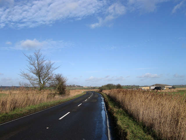
Wartling Road
A minor but busy road that links the A259 and the A271 via the village of Wartling. To the south it runs across the flat expanse of Pevensey Levels raised on a slight embankment flanked by drains and reeds. This section is approaching the junction with Church Acre Drove and Buck's Bridge with an unnamed barn to the right of the latter.
 Map © Crown Copyright")
TIP: Click the map for more Large scale mapping
- Grid Square
- TQ6507, 35 images (more nearby 🔍)
- Photographer
- Simon Carey (more nearby)
- Date Taken
- Sunday, 17 January, 2010 (more nearby)
- Submitted
- Tuesday, 19 January, 2010
- Subject Location
-
OSGB36:
 TQ 651 072 [100m precision]
WGS84: 50:50.4464N 0:20.6215E - Camera Location
-
OSGB36: TQ 650 071
- View Direction
- North-northeast (about 22 degrees)