2006
SH6446 : Cairn on plateau below Cnicht summit
taken 18 years ago, near to Croesor, Gwynedd, Wales
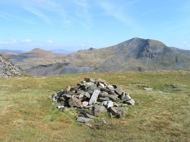
Cairn on plateau below Cnicht summit
Although it is not particularly evident on the contour maps, there is a significant sized level plateau to the southwest of the Cnicht summit. A great place to rest and possibly shelter from the wind before the final ascent. This cairn has been built in the middle of it, and the view shown is southeast off the open side of the shelf towards Moelwyn Mawr.
 Map © Crown Copyright")
TIP: Click the map for more Large scale mapping
- Grid Square
- SH6446, 79 images (more nearby 🔍)
- Photographer
- Nigel Davies (more nearby)
- Date Taken
- Saturday, 29 April, 2006 (more nearby)
- Submitted
- Wednesday, 10 May, 2006
- Subject Location
-
OSGB36:
 SH 642 463 [100m precision]
WGS84: 52:59.8055N 4:1.4931W - View Direction
- Southeast (about 135 degrees)