2010
SP3378 : Christchurch Spire, Coventry
taken 14 years ago, near to Coventry, England
This is 1 of 2 images, with title Christchurch Spire, Coventry in this square
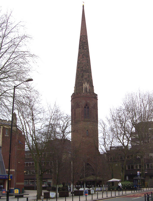
Christchurch Spire, Coventry
All that remains of Christchurch is the spire. The rest was destroyed in an air raid on 8th. April 1941.
 Map © Crown Copyright")
TIP: Click the map for more Large scale mapping
- Grid Square
- SP3378, 1565 images (more nearby 🔍)
- Photographer
- David P Howard (more nearby)
- Date Taken
- Saturday, 23 January, 2010 (more nearby)
- Submitted
- Saturday, 23 January, 2010
- Subject Location
-
OSGB36:
 SP 333 787 [100m precision]
WGS84: 52:24.3180N 1:30.7164W - Camera Location
-
OSGB36: SP 3324 7875
- View Direction
- EAST (about 90 degrees)