2010
NN2109 : Glen Kinglas
taken 14 years ago, 4 km ESE of Cairndow, Argyll And Bute, Scotland
This is 1 of 2 images, with title Glen Kinglas in this square
Glen Kinglas
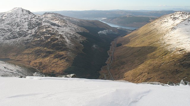
The straight A83, beloved of speed traps seen from Beinn Chorranach the northern most of the tops of Beinn Ime which dominate the view travelling eastwards. This is one of Caulfeild's military roads, and a deviation can be seen where the modern road curves slightly away from the house at Butterbridge.
Beinn an Lochain on the left, Binnein an Fhìdhleir on the right. The snow line rises as you approach Loch Fyne.
Beinn an Lochain on the left, Binnein an Fhìdhleir on the right. The snow line rises as you approach Loch Fyne.
 Map © Crown Copyright")
TIP: Click the map for more Large scale mapping
- Grid Square
- NN2109, 19 images (more nearby 🔍)
- Photographer
- Richard Webb (more nearby)
- Date Taken
- Saturday, 23 January, 2010 (more nearby)
- Submitted
- Tuesday, 26 January, 2010
- Subject Location
-
OSGB36:
 NN 21 09 [1000m precision]
WGS84: 56:14.6639N 4:52.9335W - Camera Location
-
OSGB36: NN 254 095
- View Direction
- WEST (about 270 degrees)