2010
NG3047 : Evidence of an old track?
taken 14 years ago, 3 km from Roskhill, Isle of Skye, Scotland
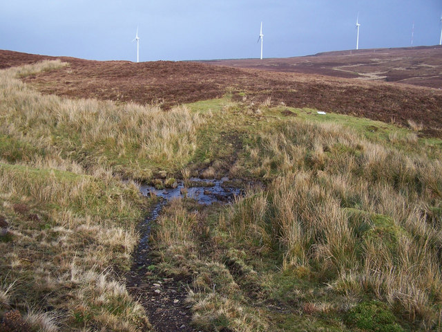
Evidence of an old track?
What looks to be a ford through one of the many tributaries of the Caroy River may just be a shepherd's quad bike route, but in this part of Gleann Eoghainn are remains of some 15 ruined shielings, so there would have been some tracks created here through the boggy moor. In the background are some of the turbines in the Ben Aketil wind farm.
 Map © Crown Copyright")
TIP: Click the map for more Large scale mapping
- Grid Square
- NG3047, 10 images (more nearby 🔍)
- Photographer
- Richard Dorrell (more nearby)
- Date Taken
- Wednesday, 27 January, 2010 (more nearby)
- Submitted
- Wednesday, 27 January, 2010
- Subject Location
-
OSGB36:
 NG 305 473 [100m precision]
WGS84: 57:26.1969N 6:29.5216W - Camera Location
-
OSGB36: NG 305 473
- View Direction
- East-northeast (about 67 degrees)