2010
ST6744 : Former toll house, on the A361, near East Cranmore
taken 14 years ago, near to East Cranmore, Somerset, England
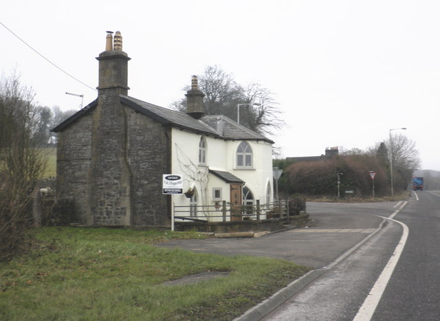
Former toll house, on the A361, near East Cranmore
 Map © Crown Copyright")
TIP: Click the map for more Large scale mapping
- Grid Square
- ST6744, 10 images (more nearby 🔍)
- Photographer
- Roger Cornfoot (more nearby)
- Date Taken
- Wednesday, 27 January, 2010 (more nearby)
- Submitted
- Friday, 29 January, 2010
- Subject Location
-
OSGB36:
 ST 679 441 [100m precision]
WGS84: 51:11.7506N 2:27.5860W - Camera Location
-
OSGB36: ST 679 441
- View Direction
- East-northeast (about 67 degrees)