2010
SJ6807 : The Dun Cow, Dawley
taken 14 years ago, near to Dawley, Telford And Wrekin, England
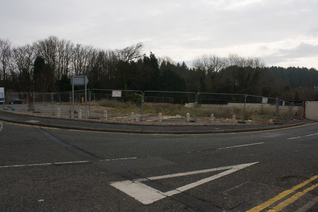
The Dun Cow, Dawley
It was demolished in early 2009, and the adjacent SJ6807 : Lord Hill, Dawley awaits the same fate. It had a fine bowling green with two stands for spectators: SJ6807 : Bowling Green at the Dun Cow.
 Map © Crown Copyright")
TIP: Click the map for more Large scale mapping
- Grid Square
- SJ6807, 55 images (more nearby 🔍)
- Photographer
- Mike White (more nearby)
- Date Taken
- Wednesday, 27 January, 2010 (more nearby)
- Submitted
- Sunday, 31 January, 2010
- Subject Location
-
OSGB36:
 SJ 685 073 [100m precision]
WGS84: 52:39.7823N 2:27.9688W - Camera Location
-
OSGB36: SJ 685 073
- View Direction
- Southeast (about 135 degrees)