2007
SK4333 : Floods at Ambaston
taken 17 years ago, near to Draycott, Derbyshire, England
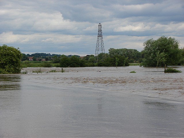
Floods at Ambaston
The river Derwent burst its banks during the floods of June 2007. Fortunately our protective flood bank was not overtopped. This was the view from Cow Lane looking towards Draycott. For a picture of the same area when not flooded see SK4333 : Ambaston - flood plain of the Derwent.
 Map © Crown Copyright")
TIP: Click the map for more Large scale mapping
- Grid Square
- SK4333, 39 images (more nearby 🔍)
- Photographer
- Richard Green (more nearby)
- Date Taken
- Tuesday, 26 June, 2007 (more nearby)
- Submitted
- Sunday, 31 January, 2010
- Subject Location
-
OSGB36:
 SK 434 332 [100m precision]
WGS84: 52:53.7079N 1:21.3796W - Camera Location
-
OSGB36: SK 429 326
- View Direction
- Northeast (about 45 degrees)