2010
SK4863 : Field access
taken 14 years ago, near to Rowthorne, Derbyshire, England
This is 1 of 2 images, with title starting with Field in this square
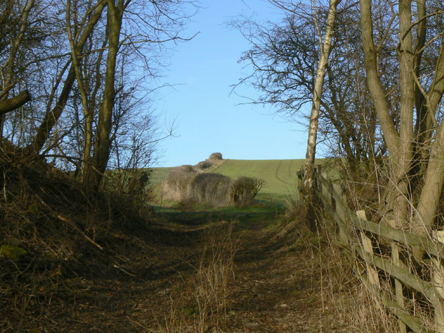
Field access
The old railway embankment forming the Rowthorne Trail has been cut away at this point to provide field access, but there would originally have been an underbridge at this location.
 Map © Crown Copyright")
TIP: Click the map for more Large scale mapping
- Grid Square
- SK4863, 36 images (more nearby 🔍)
- Photographer
- Alan Murray-Rust (more nearby)
- Date Taken
- Sunday, 31 January, 2010 (more nearby)
- Submitted
- Tuesday, 2 February, 2010
- Subject Location
-
OSGB36:
 SK 4851 6374 [10m precision]
WGS84: 53:10.1144N 1:16.5482W - Camera Location
-
OSGB36: SK 4851 6374
- View Direction
- North-northwest (about 337 degrees)