2010
TQ6705 : Rockhouse Piece
taken 14 years ago, near to Pevensey Bay, East Sussex, England
This is 1 of 2 images, with title Rockhouse Piece in this square
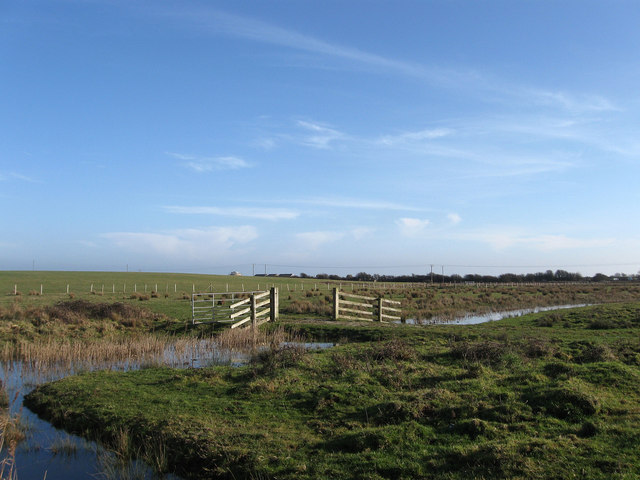
Rockhouse Piece
The name of the field according to the 1839 tithe map and part of Pevensey Bridge Level. The fence beyond marks the parish boundary between Pevensey and Bexhill as well as the district council boundary between Wealden and Rother. The ground begins to rise here and is known as Rockhouse Bank which partially obscures the view of Martello Tower number 55.
 Map © Crown Copyright")
TIP: Click the map for more Large scale mapping
- Grid Square
- TQ6705, 116 images (more nearby 🔍)
- Photographer
- Simon Carey (more nearby)
- Date Taken
- Saturday, 6 February, 2010 (more nearby)
- Submitted
- Sunday, 7 February, 2010
- Subject Location
-
OSGB36:
 TQ 674 054 [100m precision]
WGS84: 50:49.4571N 0:22.5740E - Camera Location
-
OSGB36: TQ 673 055
- View Direction
- Southeast (about 135 degrees)