2010
TQ6707 : Waterlot Stream
taken 14 years ago, near to Hooe, East Sussex, England
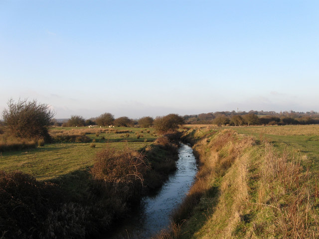
Waterlot Stream
The stream rises to the north of Hooe and drains the southern side of the Hooe Levels there before heading south under Sewer Bridge and eventually joining Waller's Haven near Reynolds Gut. The stream was originally joined an older drainage channel called the Mark Dyke and entered the sea at the small port of Coding (Sometimes called Godyngeshaven) somewhere near the modern day caravan park at Normans Bay. In 1402 the Mark Dyke became the rerouted Waller's Haven which was extended eastwards again in 1455 due to longshore drift and moving the stream's end away from the sea to its current position. The higher ground containing the village of Hooe can be seen in the distance.
 Map © Crown Copyright")
TIP: Click the map for more Large scale mapping
- Grid Square
- TQ6707, 26 images (more nearby 🔍)
- Photographer
- Simon Carey (more nearby)
- Date Taken
- Saturday, 6 February, 2010 (more nearby)
- Submitted
- Sunday, 7 February, 2010
- Subject Location
-
OSGB36:
 TQ 677 075 [100m precision]
WGS84: 50:50.5851N 0:22.8359E - Camera Location
-
OSGB36: TQ 677 075
- View Direction
- NORTH (about 0 degrees)