2010
SX6286 : Watern Tor
taken 14 years ago, 5 km WSW of Gidleigh, Devon, England
This is 1 of 5 images, with title Watern Tor in this square
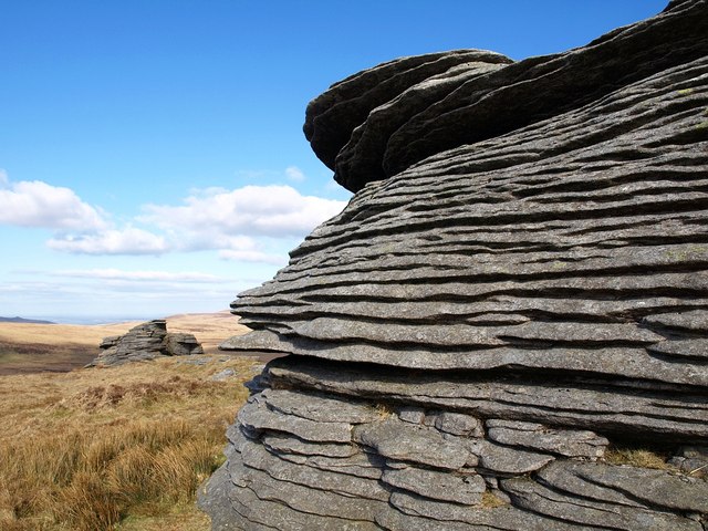
Watern Tor
In the foreground is the rock shown in SX6286 : Watern Tor, with SX6286 : Thirlstone down the hill on the left.
 Map © Crown Copyright")
TIP: Click the map for more Large scale mapping
- Grid Square
- SX6286, 17 images (more nearby 🔍)
- Photographer
- Derek Harper (more nearby)
- Date Taken
- Thursday, 11 February, 2010 (more nearby)
- Submitted
- Tuesday, 16 February, 2010
- Subject Location
-
OSGB36:
 SX 6291 8680 [10m precision]
WGS84: 50:39.8812N 3:56.4676W - Camera Location
-
OSGB36: SX 6290 8679
- View Direction
- Northeast (about 45 degrees)