2010
NZ4518 : Wolfson Research Institute
taken 14 years ago, near to Stockton-on-Tees, England
Wolfson Research Institute
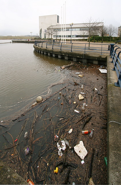
This is the waterfront of the Queen's Campus, Stockton, of the University of Durham, where the Wolfson Research Institute lies between the River Tees and NZ4518 : The Ebsworth Building. The river here is upstream of NZ4619 : Tees Barrage, which maintains the river at the level of an average high tide, 2.65m above Ordnance Datum. One of the goals of the barrage was to prevent polluted water coming upstream with the tide, but it can do nothing about material being washed downstream from inland towns and woodlands. Much floating debris used to be stranded on noxious mudbanks in this area, but now works its way down to the ponded water where there have been proposals to collect and burn it for power generation, as it does include a lot of wood as well as bottles, footballs and other plastics.
 Map © Crown Copyright")
TIP: Click the map for more Large scale mapping
- Grid Square
- NZ4518, 65 images (more nearby 🔍)
- Photographer
- Andy Waddington (more nearby)
- Date Taken
- Thursday, 18 February, 2010 (more nearby)
- Submitted
- Saturday, 20 February, 2010
- Subject Location
-
OSGB36:
 NZ 4556 1895 [10m precision]
WGS84: 54:33.8242N 1:17.8157W - Camera Location
-
OSGB36: NZ 4550 1892
- View Direction
- East-northeast (about 67 degrees)