2004
NT9219 : Unnamed waterfall on Harthope Burn
taken 20 years ago, 4 km SW of Langleeford, Northumberland, England
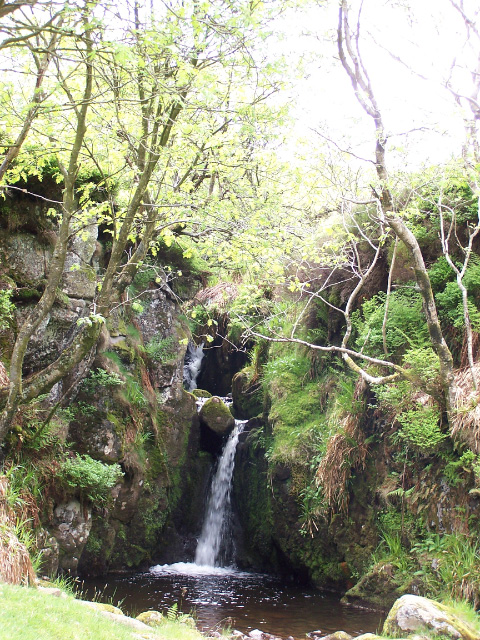
Unnamed waterfall on Harthope Burn
Waterfall in Langleeford Vale at the foot (south) of The Cheviot.
 Map © Crown Copyright")
TIP: Click the map for more Large scale mapping
- Grid Square
- NT9219, 16 images (more nearby 🔍)
- Photographer
- Ray Byrne (more nearby)
- Date Taken
- Sunday, 30 May, 2004 (more nearby)
- Submitted
- Friday, 10 June, 2005
- Subject Location
-
OSGB36:
 NT 9233 1993 [10m precision]
WGS84: 55:28.3881N 2:7.3731W - Camera Location
-
OSGB36: NT 9233 1996
- View Direction
- SOUTH (about 180 degrees)