2010
NZ6817 : Forest track near Kilton Thorpe
taken 14 years ago, near to North Skelton, Redcar And Cleveland, England
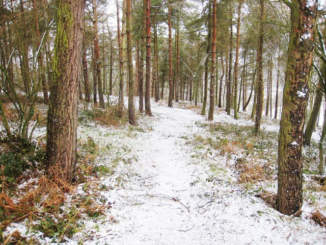
Forest track near Kilton Thorpe
This photograph shows a view of a snow-laden forest track/footpath (through Merrys Wood) which leads down towards Merry Lockwood Gill. The picture was taken from the dismantled railway looking in a westerly direction towards Wet Furrows Farm.
 Map © Crown Copyright")
TIP: Click the map for more Large scale mapping
- Grid Square
- NZ6817, 9 images (more nearby 🔍)
- Photographer
- Philip Barker (more nearby)
- Date Taken
- Sunday, 21 February, 2010 (more nearby)
- Submitted
- Monday, 22 February, 2010
- Subject Location
-
OSGB36:
 NZ 686 179 [100m precision]
WGS84: 54:33.1185N 0:56.4359W - Camera Location
-
OSGB36: NZ 687 179
- View Direction
- WEST (about 270 degrees)