2010
NZ1366 : Hadrian's Wall
taken 14 years ago, near to Heddon-on-The-Wall, Northumberland, England
This is 1 of 5 images, with title Hadrian's Wall in this square
Hadrian's Wall
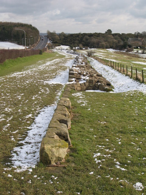
This is the longest surviving section of "broad" (approx. 3 m) Wall; the Vallum can be seen in the field on the right (marked by the change in vegetation). The Wall and Vallum at Heddon can be seen on the satellite image Link .
.
 Map © Crown Copyright")
TIP: Click the map for more Large scale mapping
- Grid Square
- NZ1366, 405 images (more nearby 🔍)
- Photographer
- Mike Quinn (more nearby)
- Date Taken
- Tuesday, 23 February, 2010 (more nearby)
- Submitted
- Wednesday, 24 February, 2010
- Subject Location
-
OSGB36:
 NZ 138 668 [100m precision]
WGS84: 54:59.7770N 1:47.1178W - Camera Location
-
OSGB36: NZ 136 669
- View Direction
- East-southeast (about 112 degrees)