2010
NS4682 : Remains of a cairn
taken 14 years ago, 3 km from Craighat, Stirling, Scotland
This is 1 of 2 images, with title Remains of a cairn in this square
Remains of a cairn
See NS4682 : Remains of a cairn for the main description.
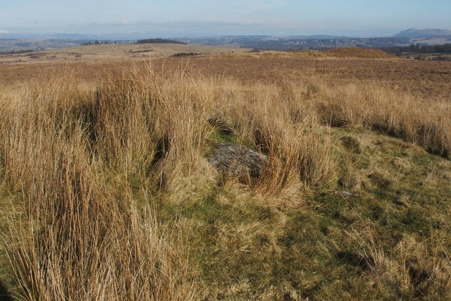
This view shows a slab, which is more or less all that now remains of the cairn, in its context; it is located among tall grasses on the top of a greenish mound.
The Fintry Hills can be seen at the right-hand edge of the photo. Note also, in the middle distance, a ridge in the right-hand half of the photo; see NS4782 : View along mound. The houses of Killearn can be seen behind that ridge.
Remains of a cairn
See Link
(at Canmore) for archaeological details.
 Map © Crown Copyright")
TIP: Click the map for more Large scale mapping
- Grid Square
- NS4682, 37 images (more nearby 🔍)
- Photographer
- Lairich Rig (more nearby)
- Date Taken
- Friday, 19 February, 2010 (more nearby)
- Submitted
- Thursday, 25 February, 2010
- Subject Location
-
OSGB36:
 NS 4693 8270 [10m precision]
WGS84: 56:0.7626N 4:27.4143W - Camera Location
-
OSGB36: NS 4692 8269
- View Direction
- Northeast (about 45 degrees)