2010
SO5611 : Path, Marian's Inclosure
taken 14 years ago, near to Berry Hill, Gloucestershire, England
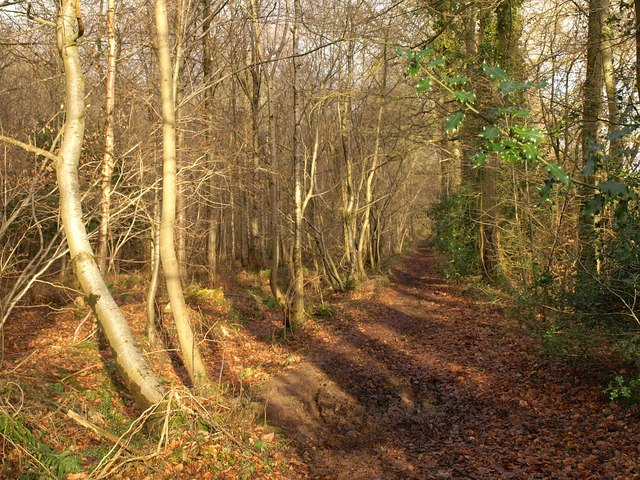
Path, Marian's Inclosure
The footpath runs along the forest edge shown on the left of SO5611 : Pasture, Rushmere Farm, and curiously is not numbered as a public footpath, even though it links Mary's Lane (Coleford footpath 1/1) and Coleford 14/1. I went flying just here - very slippery taken at speed.
 Map © Crown Copyright")
TIP: Click the map for more Large scale mapping
- Grid Square
- SO5611, 24 images (more nearby 🔍)
- Photographer
- Derek Harper (more nearby)
- Date Taken
- Tuesday, 2 February, 2010 (more nearby)
- Submitted
- Friday, 26 February, 2010
- Subject Location
-
OSGB36:
 SO 5645 1159 [10m precision]
WGS84: 51:48.0748N 2:37.9780W - Camera Location
-
OSGB36: SO 5643 1157
- View Direction
- Northeast (about 45 degrees)