2006
NS7347 : The Martyr's Grave
taken 18 years ago, near to Glassford, South Lanarkshire, Scotland
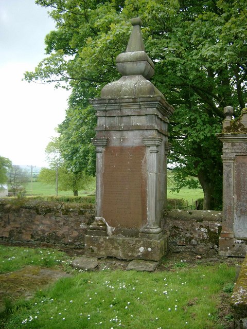
The Martyr's Grave
William Gordon of Earlston, near St John's Town of Dalry, was banished from Scotland for his support of the Covenanters. He was able to return to Scotland and was making his way towards Bothwell Bridge on 22 June 1679 when he was met by dragoons near to Crookedstone farm in Hamilton parish and shot dead. Requests to allow him burial in Dalry were refused, so his grave can be seen here at Glassford kirkyard.
 Map © Crown Copyright")
TIP: Click the map for more Large scale mapping
- Grid Square
- NS7347, 16 images (more nearby 🔍)
- Photographer
- Gordon Brown (more nearby)
- Date Taken
- Sunday, 21 May, 2006 (more nearby)
- Submitted
- Sunday, 21 May, 2006
- Subject Location
-
OSGB36:
 NS 732 470 [100m precision]
WGS84: 55:41.9894N 4:1.1489W - Camera Location
-
OSGB36: NS 732 470
- View Direction
- Southwest (about 225 degrees)