2010
SX8476 : Clay waste polluting the Teign (1/2)
taken 14 years ago, near to Chudleigh Knighton, Devon, England
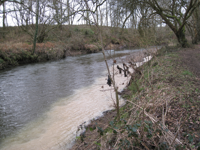
Clay waste polluting the Teign (1/2)
Compare SX8476 : Bend of the River Teign northwest of Southacre quarry taken a few metres upstream earlier in the year.
 Map © Crown Copyright")
TIP: Click the map for more Large scale mapping
- Grid Square
- SX8476, 104 images (more nearby 🔍)
- Photographer
- Robin Stott (more nearby)
- Date Taken
- Sunday, 21 February, 2010 (more nearby)
- Submitted
- Monday, 1 March, 2010
- Subject Location
-
OSGB36:
 SX 848 762 [100m precision]
WGS84: 50:34.4489N 3:37.6946W - Camera Location
-
OSGB36: SX 848 762
- View Direction
- Northwest (about 315 degrees)