2010
NZ3575 : The causeway to St Mary's Island
taken 14 years ago, near to Hartley, Northumberland, England
This is 1 of 3 images, with title The causeway to St Mary's Island in this square
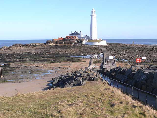
The causeway to St Mary's Island
At low tide, it is possible to walk out to the island.
 Map © Crown Copyright")
TIP: Click the map for more Large scale mapping
- Grid Square
- NZ3575, 225 images (more nearby 🔍)
- Photographer
- Oliver Dixon (more nearby)
- Date Taken
- Monday, 1 March, 2010 (more nearby)
- Submitted
- Friday, 5 March, 2010
- Subject Location
-
OSGB36:
 NZ 352 754 [100m precision]
WGS84: 55:4.3090N 1:26.9613W - Camera Location
-
OSGB36: NZ 351 752
- View Direction
- Northeast (about 45 degrees)