2010
SE1033 : Terrace houses, Allerton Upper Green, Upper Allerton Lane, Allerton
taken 14 years ago, near to Thornton, Bradford, England
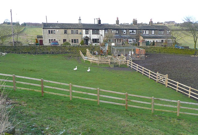
Terrace houses, Allerton Upper Green, Upper Allerton Lane, Allerton
This row is shown on the 1852 OS map. There were no mills or coalpits nearby at that time, so they were perhaps built for agricultural workers. Possibly they were building club houses, the terrace being gradually extended as the members' contributions provided enough capital for another house.
 Map © Crown Copyright")
TIP: Click the map for more Large scale mapping
- Grid Square
- SE1033, 39 images (more nearby 🔍)
- Photographer
- Humphrey Bolton (more nearby)
- Date Taken
- Tuesday, 2 March, 2010 (more nearby)
- Submitted
- Saturday, 6 March, 2010
- Subject Location
-
OSGB36:
 SE 102 338 [100m precision]
WGS84: 53:48.0243N 1:50.7971W - Camera Location
-
OSGB36: SE 102 338
- View Direction
- North-northeast (about 22 degrees)