SX8575 : Looking southwest across White Pit Quarry
taken 14 years ago, near to Sandygate, Devon, England
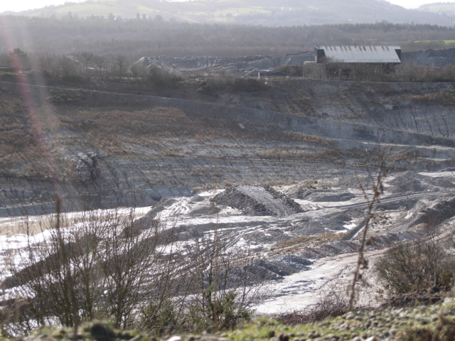
Ball clay is an ultra-fine clay of great value in the manufacture of tableware, sanitary ware, electrical insulators and tiles. Blended with coarser clays such as china clay it maintains the shape, strength and stability of unfired ceramic articles. After firing it is off-white or cream, therefore does not sully white and light-coloured glazes. The industry began in the 16th century with the manufacture of long-stemmed tobacco pipes, notably at Exeter. Other historic uses include the fine china known as cream ware, and as a component of Coade stone, a highly durable artificial stone for architectural decoration and statuary.
Originally dug as a cube from the floor of a clay pit, manhandling and transport knocked off the edges and corners resulting in a rough ball, hence the name ball clay; quarrying companies sometimes refer to it as plastic clay. Worldwide, deposits of ball clay are rare. The Bovey Basin in the floodplain of the River Teign north of Newton Abbot, Devon, is a major source. In Britain, less extensive deposits occur at Petrockstowe in North Devon and at Wareham in Dorset. In Devon, quarrying and disposal of waste are regulated by the County Councils Minerals Local Plan, adopted in 2004. It looks forward to the year 2100 or such time as it is superseded by a Minerals and Waste Development Framework. The industry has had, and continues to have, a profound influence on the local economy, transport network and environment. As a result of amalgamations and takeovers only two companies currently control the extraction of clays in the Bovey Basin: Imerys (French) and Sibelco (Belgian).
The Bovey Basin is covered by the Ordnance Surveys Explorer map no.110. It shows several largely featureless white spaces labelled Clay Pits. On the ground it comes as a shock to see the extent and depth of the open-cast quarries. Some so-called pits are in reality permanent-looking spoil heaps. Thus there are difficulties in establishing the names and locations of features in this landscape. Current and historic workings extend across some sixteen grid squares in the SX87 hectad. LinkLink
 Map © Crown Copyright")
- Grid Square
- SX8575, 35 images (more nearby 🔍)
- Photographer
- Robin Stott (more nearby)
- Date Taken
- Friday, 26 February, 2010 (more nearby)
- Submitted
- Sunday, 7 March, 2010
- Subject Location
-
OSGB36:
 SX 857 757 [100m precision]
WGS84: 50:34.1899N 3:36.9231W - Camera Location
-
OSGB36: SX 859 759
- View Direction
- Southwest (about 225 degrees)