2010
SW4930 : Long Rock
taken 14 years ago, near to Longrock, Cornwall, England
This is 1 of 2 images, with title Long Rock in this square
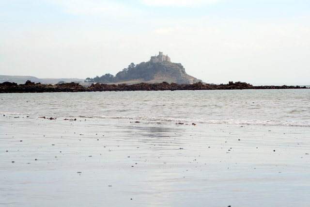
Long Rock
This long low reef gives its name to the long stretch of beach which runs from Penzance to Marazion. It is rarely as exposed as it is here on an exceptionally low spring tide.
 Map © Crown Copyright")
TIP: Click the map for more Large scale mapping
- Grid Square
- SW4930, 12 images (more nearby 🔍)
- Photographer
- Rod Allday (more nearby)
- Date Taken
- Wednesday, 3 March, 2010 (more nearby)
- Submitted
- Tuesday, 9 March, 2010
- Subject Location
-
OSGB36:
 SW 4983 3079 [10m precision]
WGS84: 50:7.4602N 5:30.0832W - Camera Location
-
OSGB36: SW 4957 3093
- View Direction
- East-southeast (about 112 degrees)