2008
SP1692 : Wiggins Hill Bridge near Curdworth, Warwickshire
taken 16 years ago, near to Curdworth, Warwickshire, England
This is 1 of 2 images, with title Wiggins Hill Bridge near Curdworth, Warwickshire in this square
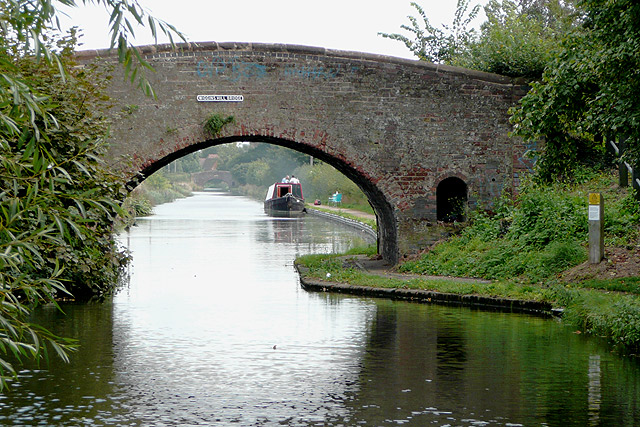
Wiggins Hill Bridge near Curdworth, Warwickshire
Birmingham and Fazeley Canal.
The original purpose of this canal was to provide a link between Birmingham and the south east of England, by way of the Coventry Canal and the Oxford Canal. John Smeaton was the engineer, and the canal was completed in 1789.
The bridge carries Wiggins Hill Road from the A4097 (which is to the right) to Over Green and Grove End.
 Map © Crown Copyright")
TIP: Click the map for more Large scale mapping
- Grid Square
- SP1692, 37 images (more nearby 🔍)
- Photographer
- Roger D Kidd (more nearby)
- Date Taken
- Wednesday, 10 September, 2008 (more nearby)
- Submitted
- Tuesday, 9 March, 2010
- Subject Location
-
OSGB36:
 SP 167 927 [100m precision]
WGS84: 52:31.9202N 1:45.2706W - Camera Location
-
OSGB36: SP 167 927
- View Direction
- East-northeast (about 67 degrees)