2010
SH6220 : Bwlch y Rhiwgyr
taken 14 years ago, 3 km from Cutiau, Gwynedd, Wales
This is 1 of 4 images, with title Bwlch y Rhiwgyr in this square
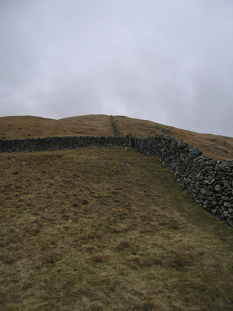
Bwlch y Rhiwgyr
Looking up the Diffwys ridge from Bwlch y Rhiwgyr, the pass on the track from Bontddu to Dyffryn Ardudwy. The stone wall follows the crest of the ridge all the way from Abermaw/Barmouth to Rhinog Fach, 13km in total.
 Map © Crown Copyright")
TIP: Click the map for more Large scale mapping
- Grid Square
- SH6220, 30 images (more nearby 🔍)
- Photographer
- Rudi Winter (more nearby)
- Date Taken
- Saturday, 13 March, 2010 (more nearby)
- Submitted
- Sunday, 14 March, 2010
- Subject Location
-
OSGB36:
 SH 627 201 [100m precision]
WGS84: 52:45.6603N 4:2.1696W - Camera Location
-
OSGB36: SH 626 200
- View Direction
- Northeast (about 45 degrees)