TQ9220 : Railway crosses the Rother
taken 14 years ago, near to Rye, East Sussex, England
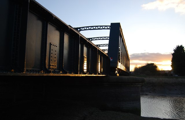
This line runs between Hastings and Ashford.The South Eastern Railway built the line, it opened on 13 February 1851. Recommended for closure by Dr. Beeching in 1963, the route has survived various attempts to axe services completely, and stations remained unmodernised and gas-lit well into the 1970s. Services for certain stations on the line have now been reduced to an absolute minimum.
The line was single tracked between Appledore and Ore 1 October 1979, leaving a passing loop at Rye. Several stations have staggered platforms: passengers cross the line from the end of one platform to the end of the other, thus avoiding a footbridge.
The line is not electrified, with the exception of Hastings to Ore. This small section was electrified to provide for carriage sidings (there was no space at Hastings) as part of the "East Coastway" electrification of July 1935.
The line has an active rail users group called "The Marsh Link Action Group". Website Link
Wikipedia Website Link
The River Rother runs for 35 miles from Rotherfield, East Sussex, entering Kent after Bodiam where it follows the county border to Wittersham, where it rejoins East Sussex to the mouth at Rye.
There are two other River Rothers in Yorkshire and in Hampshire to West Sussex.
 Map © Crown Copyright")
- Grid Square
- TQ9220, 1467 images (more nearby 🔍)
- Photographer
- N Chadwick (more nearby)
- Date Taken
- Saturday, 6 March, 2010 (more nearby)
- Submitted
- Tuesday, 16 March, 2010
- Subject Location
-
OSGB36:
 TQ 924 209 [100m precision]
WGS84: 50:57.3394N 0:44.3360E - Camera Location
-
OSGB36: TQ 924 209
- View Direction
- West-southwest (about 247 degrees)