2006
SK0068 : Three Shire Heads
taken 18 years ago, near to Flash, Staffordshire, England
This is 1 of 5 images, with title Three Shire Heads in this square
Three Shire Heads
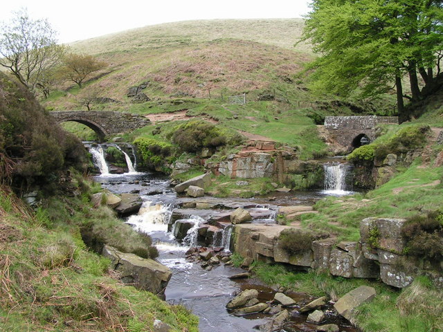
Variously known as "Three Shires Head" (probably the most popular form) and "Three Shire Heads" (the OS's preferred designation), this is a well-known beauty spot where the counties of Derbyshire (in the centre, beyond and between the two streams), Cheshire (left) and Staffordshire (right) meet. This is the traditional view of the scene, from the south. The left-hand stream is the River Dane; the right-hand is unnamed on the map, but is presumably Black Clough, after which a nearby farm is named. The pool is known as Panniers Pool, a references to the packhorses that once used the bridges. Three Shire Heads appeared on the cover of one edition of the Ordnance Survey Explorer map OL1 ("Dark Peak"), despite the site actually being on the White Peak sheet.
 Map © Crown Copyright")
TIP: Click the map for more Large scale mapping
- Grid Square
- SK0068, 64 images (more nearby 🔍)
- Photographer
- Dave Dunford (more nearby)
- Date Taken
- Saturday, 27 May, 2006 (more nearby)
- Submitted
- Sunday, 28 May, 2006
- Subject Location
-
OSGB36:
 SK 009 685 [100m precision]
WGS84: 53:12.8136N 1:59.2788W - View Direction
- North-northeast (about 22 degrees)