2010
SO7890 : Fields towards Beobridge, Shropshire
taken 14 years ago, near to Bobbington, Staffordshire, England
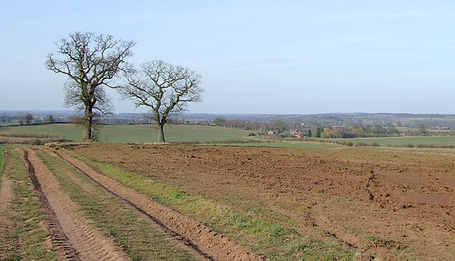
Fields towards Beobridge, Shropshire
The buildings around Honeybourne Grange are in the centre of the picture about half a mile (about eight hundred metres) distant. The (Triassic) Bunter Sandstone underlying rock gives the reddish colour to the sandy soil. Claverley is beyond the oak tree on the right, about one and a half miles (2.5 km) north.
 Map © Crown Copyright")
TIP: Click the map for more Large scale mapping
- Grid Square
- SO7890, 27 images (more nearby 🔍)
- Photographer
- Roger D Kidd (more nearby)
- Date Taken
- Tuesday, 16 March, 2010 (more nearby)
- Submitted
- Saturday, 20 March, 2010
- Subject Location
-
OSGB36:
 SO 789 908 [100m precision]
WGS84: 52:30.9145N 2:18.6999W - Camera Location
-
OSGB36: SO 789 908
- View Direction
- North-northeast (about 22 degrees)