2006
SX7174 : East Webburn valley from near Stone Cross
taken 18 years ago, near to Buckland in The Moor, Devon, England
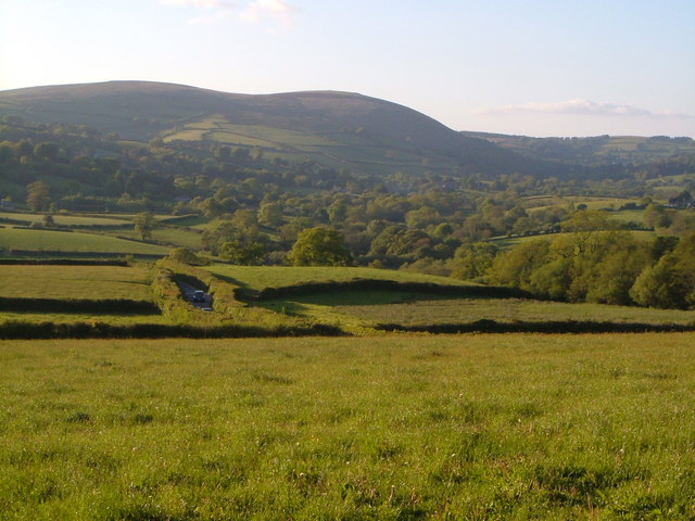
East Webburn valley from near Stone Cross
Cars approach Stone Cross up the steep lane from Cockingford. Beyond, Hamel Down closes in the west side of the valley.
 Map © Crown Copyright")
TIP: Click the map for more Large scale mapping
- Grid Square
- SX7174, 14 images (more nearby 🔍)
- Photographer
- Derek Harper (more nearby)
- Date Taken
- Tuesday, 30 May, 2006 (more nearby)
- Submitted
- Tuesday, 30 May, 2006
- Subject Location
-
OSGB36:
 SX 719 746 [100m precision]
WGS84: 50:33.4247N 3:48.5867W - Camera Location
-
OSGB36: SX 718 744
- View Direction
- North-northeast (about 22 degrees)