2010
J3268 : Pond, Minnowburn, Belfast (1)
taken 14 years ago, 3 km from Drumbeg, Co Down, Northern Ireland
Pond, Minnowburn, Belfast (1)
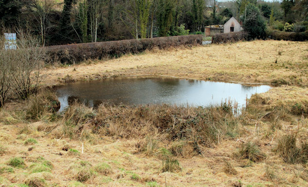
An area to the south of the Ballylesson Road J3268 : The Ballylesson Road near Belfast (5) (behind the hedge) is prone to flooding and has a (more or less) permanent pond (not shown on the 1:12,000 map). It varies in size according to the amount of rain and can at times be two small ones. This is the northern side of todays single large pond. Continue to J3268 : Pond, Minnowburn, Belfast (2).
Loading map... (JavaScript required)
- Grid Square
- J3268, 816 images (more nearby 🔍)
- Photographer
- Albert Bridge (more nearby)
- Date Taken
- Friday, 2 April, 2010 (more nearby)
- Submitted
- Friday, 2 April, 2010
- Subject Location
-
Irish:
 J 327 685 [100m precision]
WGS84: 54:32.8829N 5:56.9465W - Camera Location
-
Irish: J 327 685
- View Direction
- EAST (about 90 degrees)