2006
ST5947 : Pond at bottom of dry valley
taken 18 years ago, near to East Horrington, Somerset, England
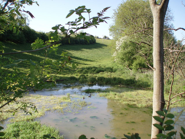
Pond at bottom of dry valley
Water has accumulated here at the bottom of a dry valley to form a largish pond where ducks were swimming. There doesn't, however, appear to be a stream running into it.
 Map © Crown Copyright")
TIP: Click the map for more Large scale mapping
- Grid Square
- ST5947, 6 images (more nearby 🔍)
- Photographer
- Sharon Loxton (more nearby)
- Date Taken
- Friday, 2 June, 2006 (more nearby)
- Submitted
- Friday, 2 June, 2006
- Subject Location
-
OSGB36:
 ST 591 474 [100m precision]
WGS84: 51:13.4591N 2:35.2242W - View Direction
- NORTH (about 0 degrees)