2006
NS8478 : Pylon convergence
taken 18 years ago, near to High Bonnybridge, Falkirk, Scotland
This is 1 of 2 images, with title starting with Pylon in this square
Pylon convergence
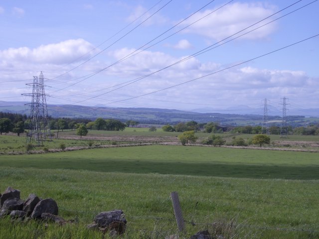
Pylons from the southwest and southeast converge here and march north together. The 1940s map shows one set of pylons crossing the square but to the north of Greenrig.
The hills beyond the further away pylons are Stuc a Chroin and Ben Vorlich.
The hills beyond the further away pylons are Stuc a Chroin and Ben Vorlich.
 Map © Crown Copyright")
TIP: Click the map for more Large scale mapping
- Grid Square
- NS8478, 10 images (more nearby 🔍)
- Photographer
- Callum Black (more nearby)
- Date Taken
- Saturday, 3 June, 2006 (more nearby)
- Submitted
- Saturday, 3 June, 2006
- Subject Location
-
OSGB36:
 NS 844 783 [100m precision]
WGS84: 55:59.0223N 3:51.2631W - Camera Location
-
OSGB36: NS 846 781
- View Direction
- Northwest (about 315 degrees)