2005
SD5621 : Buckshaw Village
taken 19 years ago, near to Worden, Lancashire, England
This is 1 of 2 images, with title starting with Buckshaw in this square
Buckshaw Village
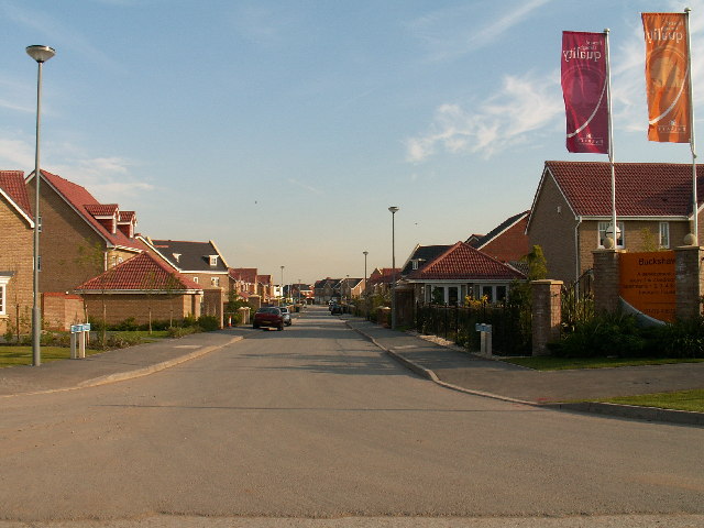
As described in SD5620, this whole area was until recently a Royal Ordnance weapons factory. The land is now being redeveloped into a large housing development. This picture shows the first stage of the development.
 Map © Crown Copyright")
TIP: Click the map for more Large scale mapping
- Grid Square
- SD5621, 27 images (more nearby 🔍)
- Photographer
- Martin Stockdale (more nearby)
- Date Taken
- Sunday, 12 June, 2005 (more nearby)
- Submitted
- Monday, 13 June, 2005
- Subject Location
-
OSGB36:
 SD 56 21 [1000m precision]
WGS84: 53:41.2877N 2:39.6101W