2010
SP5723 : Benchmark on Bucknell Road railway bridge
taken 14 years ago, near to Bicester, Oxfordshire, England
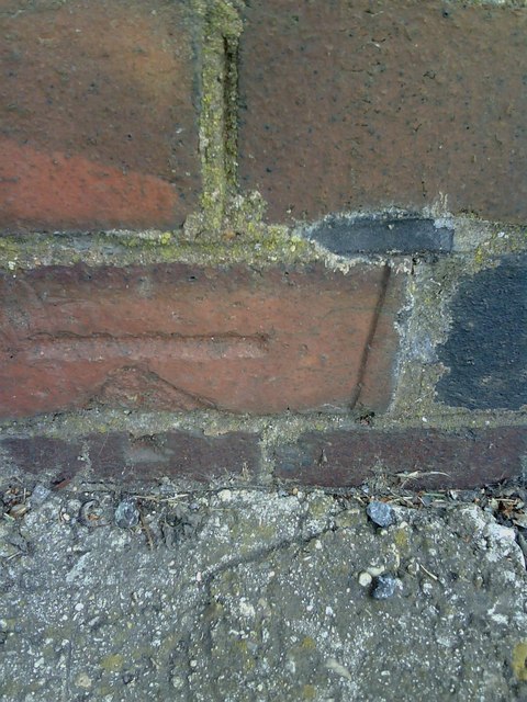
Benchmark on Bucknell Road railway bridge
1970 Ordnance Survey cut mark benchmark on railway bridge NAJ3/35 10m 561yds. The mark was levelled at 84.600m above Newlyn datum. For more information about this and other nearby benchmarks see Link .
.
 Map © Crown Copyright")
TIP: Click the map for more Large scale mapping
- Grid Square
- SP5723, 49 images (more nearby 🔍)
- Photographer
- Roger Templeman (more nearby)
- Date Taken
- Wednesday, 28 April, 2010 (more nearby)
- Submitted
- Friday, 30 April, 2010
- Subject Location
-
OSGB36:
 SP 5722 2388 [10m precision]
WGS84: 51:54.6314N 1:10.1751W - Camera Location
-
OSGB36: SP 5722 2388
- View Direction
- Northeast (about 45 degrees)