2010
NU0020 : Moorland south of Heddon Hill
taken 14 years ago, near to Roddam, Northumberland, England
Moorland south of Heddon Hill
This photo is part of a virtual walk; go here for the start NU0120 : Track to Ilderton or here to continue NU0019 : Track south of Heddon Hill
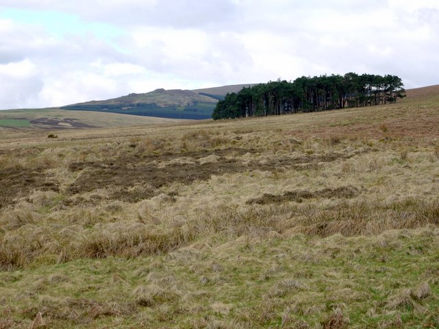
It's difficult following the right of way here as it doesn't really exist on the ground. The rule is keep out of the rough vegetation and boggy ground NU0020 : Ivy-leaved Water Crowfoot (Ranunculus hederaceous) and head for the plantation. In the distance we get the first view of Cunyan Crags and the south-east edge of Threestoneburn Wood, where we are headed. Dunmore Hill can be seen above the trees. I can see my walking companion, George, is thinking that the summit of Heddon Hill, to the north, might have been a better route NU0020 : The trig point on Heddon Hill
It's difficult following the right of way here as it doesn't really exist on the ground. The rule is keep out of the rough vegetation and boggy ground NU0020 : Ivy-leaved Water Crowfoot (Ranunculus hederaceous) and head for the plantation. In the distance we get the first view of Cunyan Crags and the south-east edge of Threestoneburn Wood, where we are headed. Dunmore Hill can be seen above the trees. I can see my walking companion, George, is thinking that the summit of Heddon Hill, to the north, might have been a better route NU0020 : The trig point on Heddon Hill
 Map © Crown Copyright")
TIP: Click the map for more Large scale mapping
- Grid Square
- NU0020, 17 images (more nearby 🔍)
- Photographer
- Andrew Curtis (more nearby)
- Date Taken
- Friday, 30 April, 2010 (more nearby)
- Submitted
- Saturday, 1 May, 2010
- Subject Location
-
OSGB36:
 NU 007 201 [100m precision]
WGS84: 55:28.4834N 1:59.3529W - Camera Location
-
OSGB36: NU 008 201
- View Direction
- Southwest (about 225 degrees)