2010
SX7236 : The South West Coast Path at Sharp Tor
taken 14 years ago, near to Salcombe, Devon, England
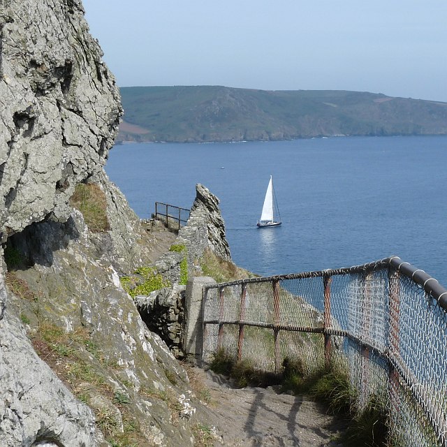
The South West Coast Path at Sharp Tor
Looking across the Salcombe Estuary.
This path was cut in the 1860s by Viscount Courtenay, son of the Earl of Devon.
This path was cut in the 1860s by Viscount Courtenay, son of the Earl of Devon.
 Map © Crown Copyright")
TIP: Click the map for more Large scale mapping
- Grid Square
- SX7236, 143 images (more nearby 🔍)
- Photographer
- Robin Drayton (more nearby)
- Date Taken
- Tuesday, 27 April, 2010 (more nearby)
- Submitted
- Monday, 3 May, 2010
- Subject Location
-
OSGB36:
 SX 729 366 [100m precision]
WGS84: 50:12.9764N 3:46.9277W - Camera Location
-
OSGB36: SX 729 366
- View Direction
- Southwest (about 225 degrees)