2006
TF2930 : River Welland at low tide
taken 18 years ago, near to Surfleet Seas End, Lincolnshire, England
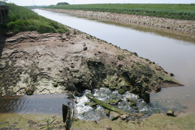
River Welland at low tide
This clearly shows the high water mark. Looking upstream from Lord's Drain outfall with the South Bank to the left and the Surfleet Bank to the right.
 Map © Crown Copyright")
TIP: Click the map for more Large scale mapping
- Grid Square
- TF2930, 22 images (more nearby 🔍)
- Photographer
- Kate Jewell (more nearby)
- Date Taken
- Friday, 9 June, 2006 (more nearby)
- Submitted
- Saturday, 10 June, 2006
- Subject Location
-
OSGB36:
 TF 293 305 [100m precision]
WGS84: 52:51.4088N 0:4.7931W - Camera Location
-
OSGB36: TF 295 307
- View Direction
- Southwest (about 225 degrees)