2010
NZ4733 : Crossroads in Naisberry
taken 14 years ago, near to Hart, Hartlepool, England
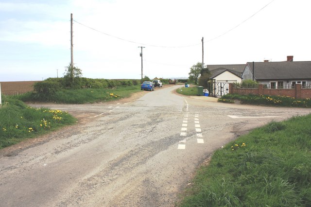
Crossroads in Naisberry
This photograph shows a view of the crossroads in Naisberry. The road to the left goes to Hart while that on the right goes to Elwick and Dalton Piercy. Naisberry Cottage is visible in the right-hand side of the image. The picture was taken from Worset Lane looking in an easterly direction towards Hartlepool.
 Map © Crown Copyright")
TIP: Click the map for more Large scale mapping
- Grid Square
- NZ4733, 7 images (more nearby 🔍)
- Photographer
- Philip Barker (more nearby)
- Date Taken
- Wednesday, 5 May, 2010 (more nearby)
- Submitted
- Wednesday, 5 May, 2010
- Subject Location
-
OSGB36:
 NZ 471 335 [100m precision]
WGS84: 54:41.7090N 1:16.2459W - Camera Location
-
OSGB36: NZ 470 335
- View Direction
- EAST (about 90 degrees)