2010
TQ4478 : Greenwich Islamic Centre
taken 14 years ago, near to Woolwich, Greenwich, England
This is 1 of 2 images, with title Greenwich Islamic Centre in this square
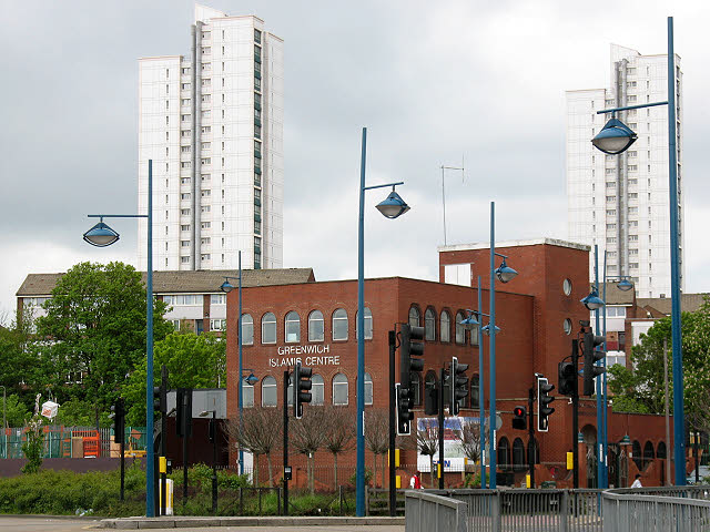
Greenwich Islamic Centre
One of the main centres of Islamic worship and teaching in south-east London.
 Map © Crown Copyright")
TIP: Click the map for more Large scale mapping
- Grid Square
- TQ4478, 117 images (more nearby 🔍)
- Photographer
- Stephen Craven (more nearby)
- Date Taken
- Sunday, 9 May, 2010 (more nearby)
- Submitted
- Sunday, 9 May, 2010
- Subject Location
-
OSGB36:
 TQ 4468 7888 [10m precision]
WGS84: 51:29.4218N 0:4.9532E - Camera Location
-
OSGB36: TQ 4467 7899
- View Direction
- SOUTH (about 180 degrees)