2006
SU1810 : North Hollow Bridge, Dockens Water, New Forest
taken 18 years ago, near to Linwood, Hampshire, England
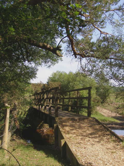
North Hollow Bridge, Dockens Water, New Forest
This footbridge spans Dockens Water, connecting Ogden's Purlieu to the NW and Black Heath to the SE. There is a ford alongside the bridge (to the right). A heron flew out from underneath the bridge as we crossed it. The bridge is labelled as "North Hollow Bridge" on Heywood Sumner's 1923 sketch map of Ibsley Common, named after the nearby hollow in the edge of Ibsley Common.
 Map © Crown Copyright")
TIP: Click the map for more Large scale mapping
- Grid Square
- SU1810, 28 images (more nearby 🔍)
- Photographer
- Jim Champion (more nearby)
- Date Taken
- Saturday, 10 June, 2006 (more nearby)
- Submitted
- Monday, 12 June, 2006
- Subject Location
-
OSGB36:
 SU 185 103 [100m precision]
WGS84: 50:53.5134N 1:44.3005W - Camera Location
-
OSGB36: SU 185 103
- View Direction
- Southeast (about 135 degrees)