2006
NT0200 : Track to Lochanhead
taken 18 years ago, near to Kinnelhead, Dumfries And Galloway, Scotland
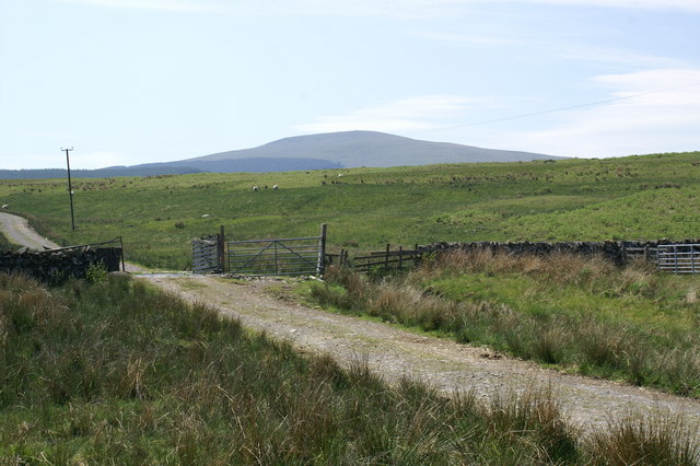
Track to Lochanhead
This route leads through grazing land past Lochanhead Farm to the fine summit of Queensberry, seen in the distance.
 Map © Crown Copyright")
TIP: Click the map for more Large scale mapping
- Grid Square
- NT0200, 11 images (more nearby 🔍)
- Photographer
- Peter Standing (more nearby)
- Date Taken
- Saturday, 10 June, 2006 (more nearby)
- Submitted
- Monday, 12 June, 2006
- Subject Location
-
OSGB36:
 NT 027 009 [100m precision]
WGS84: 55:17.5540N 3:32.0277W - View Direction
- West-southwest (about 247 degrees)