2006
TF0879 : Top Farm
taken 18 years ago, near to Fulnetby, Lincolnshire, England
This is 1 of 2 images, with title starting with Top in this square
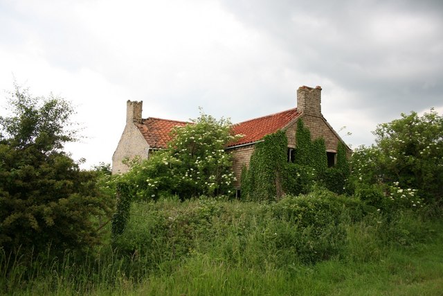
Top Farm
Ruined farm near Fulnetby
 Map © Crown Copyright")
TIP: Click the map for more Large scale mapping
- Grid Square
- TF0879, 10 images (more nearby 🔍)
- Photographer
- Richard Croft (more nearby)
- Date Taken
- Thursday, 15 June, 2006 (more nearby)
- Submitted
- Thursday, 15 June, 2006
- Subject Location
-
OSGB36:
 TF 088 796 [100m precision]
WGS84: 53:18.1311N 0:22.1289W - Camera Location
-
OSGB36: TF 089 796
- View Direction
- WEST (about 270 degrees)