2006
SS9219 : Stoodleigh: Dryhill Cross
taken 18 years ago, near to Stoodleigh, Devon, England
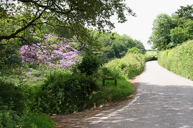
Stoodleigh: Dryhill Cross
With the entrance to Carscombe on the left and a bank of rhododendrons beyond. The road to Quoit-at-Cross, Stoodleigh, climbs and loops up above this bank. Looking north-north-west
 Map © Crown Copyright")
TIP: Click the map for more Large scale mapping
- Grid Square
- SS9219, 32 images (more nearby 🔍)
- Photographer
- Martin Bodman (more nearby)
- Date Taken
- Thursday, 15 June, 2006 (more nearby)
- Submitted
- Thursday, 15 June, 2006
- Subject Location
-
OSGB36:
 SS 9271 1930 [10m precision]
WGS84: 50:57.7860N 3:31.7498W - View Direction
- North-northwest (about 337 degrees)