2010
R3574 : Clare Castle
taken 14 years ago, near to Clarecastle, Co Clare, Ireland
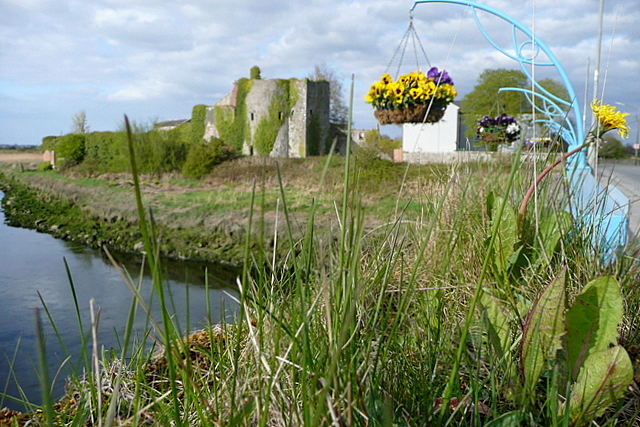
Clare Castle
The castle after which Clarecastle (town) is named. This stands on the east side of the River Fergus at its lowest crossing point and the point where it suddenly widens out into its estuary. The hanging baskets on the bridge add a bit of colour.
Loading map... (JavaScript required)
- Grid Square
- R3574, 8 images (more nearby 🔍)
- Photographer
- Graham Horn (more nearby)
- Date Taken
- Tuesday, 20 April, 2010 (more nearby)
- Submitted
- Sunday, 23 May, 2010
- Subject Location
-
Irish:
 R 352 743 [100m precision]
WGS84: 52:48.9679N 8:57.7092W - Camera Location
-
Irish: R 351 742
- View Direction
- NORTH (about 0 degrees)