2006
SJ5743 : Lane near Blackpark Farm
taken 18 years ago, near to Broughall, Shropshire, England
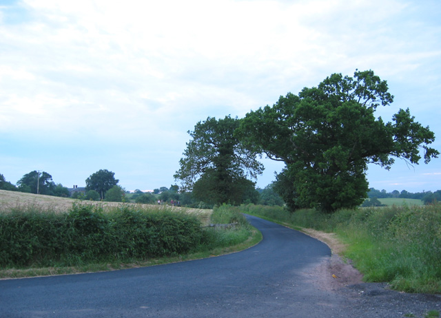
Lane near Blackpark Farm
One of the lanes from Whitchurch to Wrenbury. The lane takes a 90 degree turn north round a field boundary at this point, and a bridleway continues the line of the road eastwards (out of view on right) towards Steel's Rough Plantation. This particular lane has recently been resurfaced, making a change from the potholes of the surrounding lanes. The building whose chimneys are visible on the left is Blackpark Farm, the only habitation in this gridsquare
 Map © Crown Copyright")
TIP: Click the map for more Large scale mapping
- Grid Square
- SJ5743, 2 images (more nearby 🔍)
- Photographer
- Espresso Addict (more nearby)
- Date Taken
- Friday, 16 June, 2006 (more nearby)
- Submitted
- Saturday, 17 June, 2006
- Subject Location
-
OSGB36:
 SJ 573 431 [100m precision]
WGS84: 52:59.0117N 2:38.2474W - View Direction
- NORTH (about 0 degrees)