2010
SN1640 : Footpath diversion
taken 14 years ago, near to Llantood, Pembrokeshire/Sir Benfro, Wales
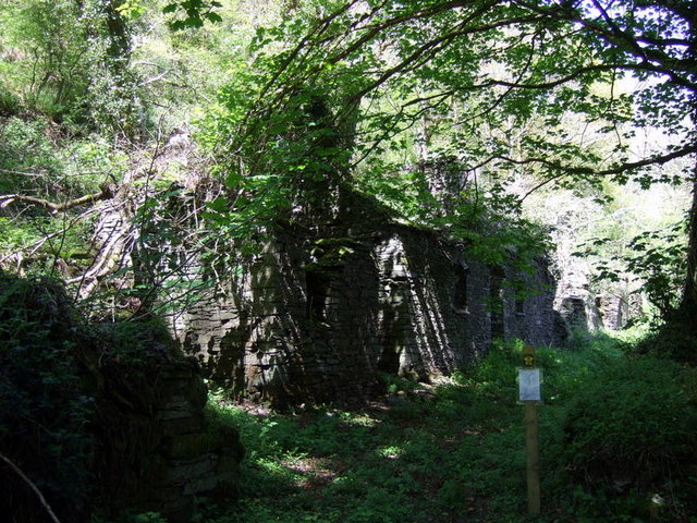
Footpath diversion
The notice attached to the post announces that "the footpath is now legally diverted". Instead of veering right through the grounds of the property named Cwm Ffrwd it continues on past these ruined dwellings and rejoins the former course of the footpath further north.
 Map © Crown Copyright")
TIP: Click the map for more Large scale mapping
- Grid Square
- SN1640, 8 images (more nearby 🔍)
- Photographer
- Natasha Ceridwen de Chroustchoff (more nearby)
- Date Taken
- Monday, 17 May, 2010 (more nearby)
- Submitted
- Thursday, 27 May, 2010
- Subject Location
-
OSGB36:
 SN 161 409 [100m precision]
WGS84: 52:2.1568N 4:40.8977W - Camera Location
-
OSGB36: SN 161 409
- View Direction
- North-northeast (about 22 degrees)