2006
NM8560 : Allt Fèith 'n Abhainn
taken 18 years ago, 5 km ESE of Strontian, Highland, Scotland
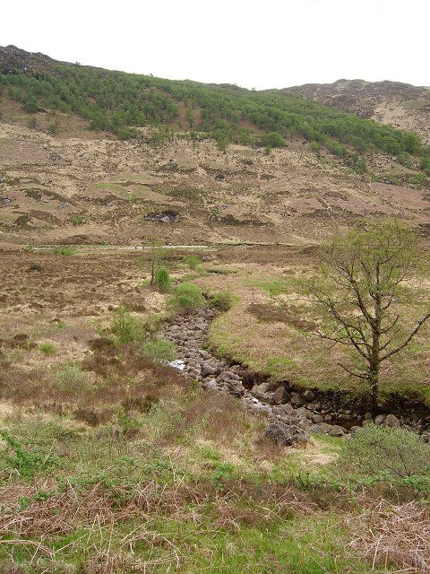
Allt Fèith 'n Abhainn
Not the main burn but a branch. The burn splits as it descends the rough granite slopes towards Glen Tarbert. A birch wood on the opposite slopes.
 Map © Crown Copyright")
TIP: Click the map for more Large scale mapping
- Grid Square
- NM8560, 7 images (more nearby 🔍)
- Photographer
- Richard Webb (more nearby)
- Date Taken
- Sunday, 21 May, 2006 (more nearby)
- Submitted
- Monday, 19 June, 2006
- Subject Location
-
OSGB36:
 NM 857 606 [100m precision]
WGS84: 56:41.2706N 5:30.0497W - View Direction
- SOUTH (about 180 degrees)