2010
TF9824 : Trackbed North of Bridge 1708
taken 14 years ago, near to Guist, Norfolk, England
This is 1 of 2 images, with title Trackbed North of Bridge 1708 in this square
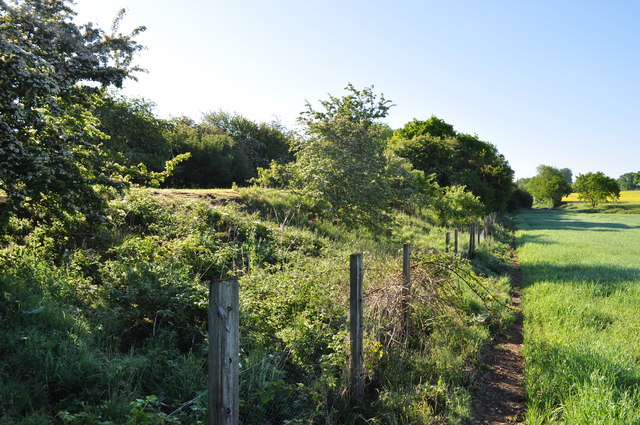
Trackbed North of Bridge 1708
A view of the embankment and lineside fencing, looking towards County School.
The Trackbed north of County School to Fakenham Gas Museum (including M&GN trackbed) is in private hands but protected from development. The major obstacle being Great Ryburgh Maltings, being built on the tarckbed.
The Trackbed north of County School to Fakenham Gas Museum (including M&GN trackbed) is in private hands but protected from development. The major obstacle being Great Ryburgh Maltings, being built on the tarckbed.
The Wells to Wymondham Branch Line
The branch line was one of the longest lines in East Anglia, running from Wymondham to Wells next the Sea, through four major Norfolk towns.
 Map © Crown Copyright")
TIP: Click the map for more Large scale mapping
- Grid Square
- TF9824, 11 images (more nearby 🔍)
- Photographer
- Ashley Dace (more nearby)
- Date Taken
- Thursday, 3 June, 2010 (more nearby)
- Submitted
- Thursday, 3 June, 2010
- Subject Location
-
OSGB36:
 TF 985 240 [100m precision]
WGS84: 52:46.6504N 0:56.5450E - Camera Location
-
OSGB36: TF 985 240
- View Direction
- Southeast (about 135 degrees)