2010
NJ1166 : Millie Burn
taken 14 years ago, near to Burghead, Moray, Scotland
This is 1 of 3 images, with title Millie Burn in this square
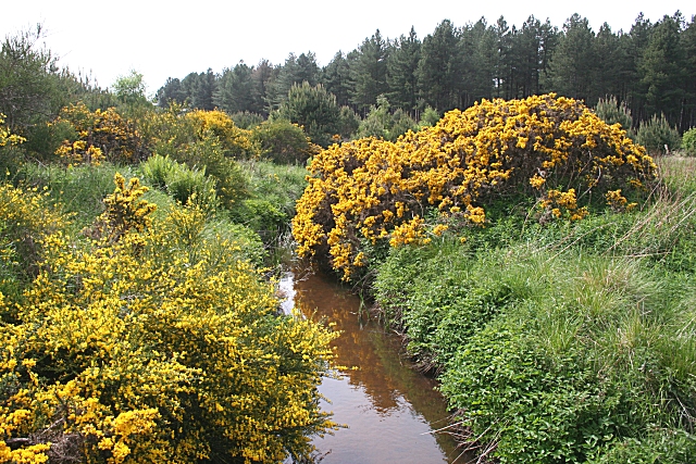
Millie Burn
The burn is fed by drainage ditches on the flat land west of College of Roseisle, and a bridge carries the coastal path over it here. This is the view downstream.
 Map © Crown Copyright")
TIP: Click the map for more Large scale mapping
- Grid Square
- NJ1166, 16 images (more nearby 🔍)
- Photographer
- Anne Burgess (more nearby)
- Date Taken
- Thursday, 3 June, 2010 (more nearby)
- Submitted
- Friday, 4 June, 2010
- Subject Location
-
OSGB36:
 NJ 112 665 [100m precision]
WGS84: 57:40.7897N 3:29.4336W - Camera Location
-
OSGB36: NJ 112 665
- View Direction
- WEST (about 270 degrees)